| View previous topic :: View next topic |
Pete Jones
Site Admin

In: Virginia
|
|
 |
|
Australia itself is connected directly to this structure. Here's what I think is the proof (assuming this is all natural and not artefacts of imagery etc etc).
Start with this bit of parallelism:
And of course, this southerly trench is part of our overall structure, if you recall.*
But there's a gap in this southerly trench. It gets cut by a couple diagonals in a triangle shape:
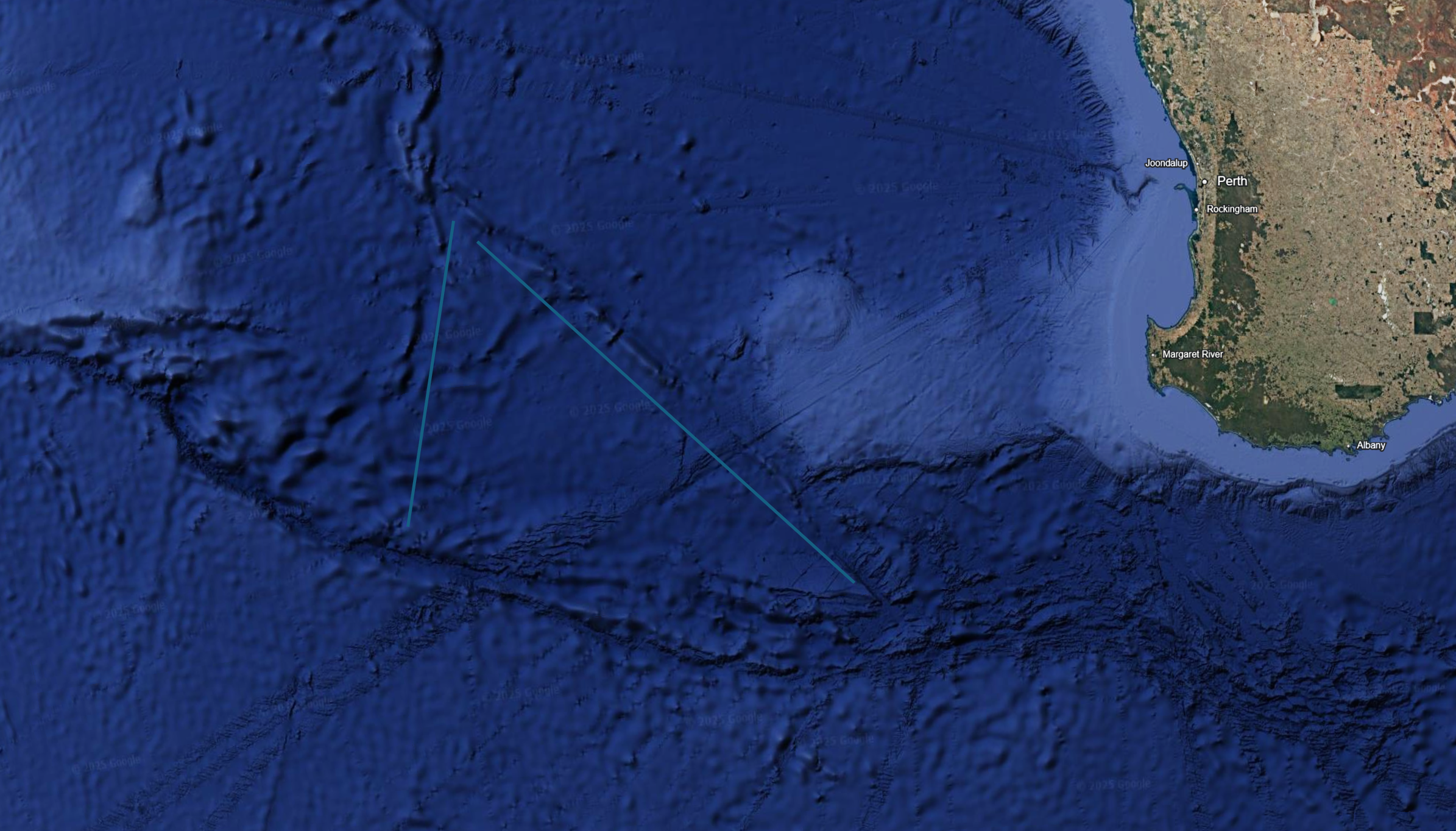
So now, on the other side of this triangle shape, the structure continues:
So, the trenches that are linked to The Warthogs and the other stuff is all connected to Australia. Antarctica too?
___________________________________________________
* remember?
|
|
 |
|
 |
|
Mick Harper
Site Admin

In: London
|
|
|
|
It seems impressively unarguable and of great importance but can you explore the possibilities (in the absence of a movie that we can directly access from or on the AEL) of using graphics shorn of extraneous details and overbold colours?
The 'originals' are necessary to establish the facts but radically simplified ones would be a great help to understand what's going on. (Including sticking to a single frame of preferably north/south reference and, if practical, a single linear scale.)
|
|
| |
|
|
|
Pete Jones
Site Admin
In: Virginia
|
|
|
|
(Suggestions noted, but right now, I don't know what to simplify, meaning I could simplify out the crucial bit that I need to make sense of it all. Once I'm done with this train of thought, I will implement your suggestions.)
Look at the two long grey lines. Their lengths don't matter, but the way they line up at the top and bottom does:
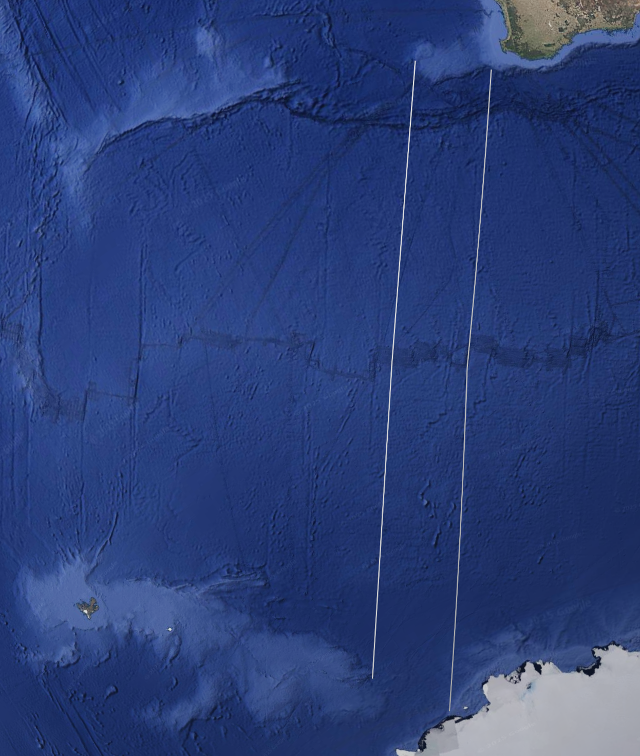
At the top, the space between the two lines is filled by a lighter, shallower chunk of seafloor. At the bottom, there is an area of deeper seafloor. Our shallower chunk up above looks like it could slide right into that gap.
Turns out, the space between the gray lines at the top is 448 km and the space at the bottom is 428 km. They are 95% the same.
In the picture below, I have excised 2,500 km of sea between these two parallel areas, it looks something like this:
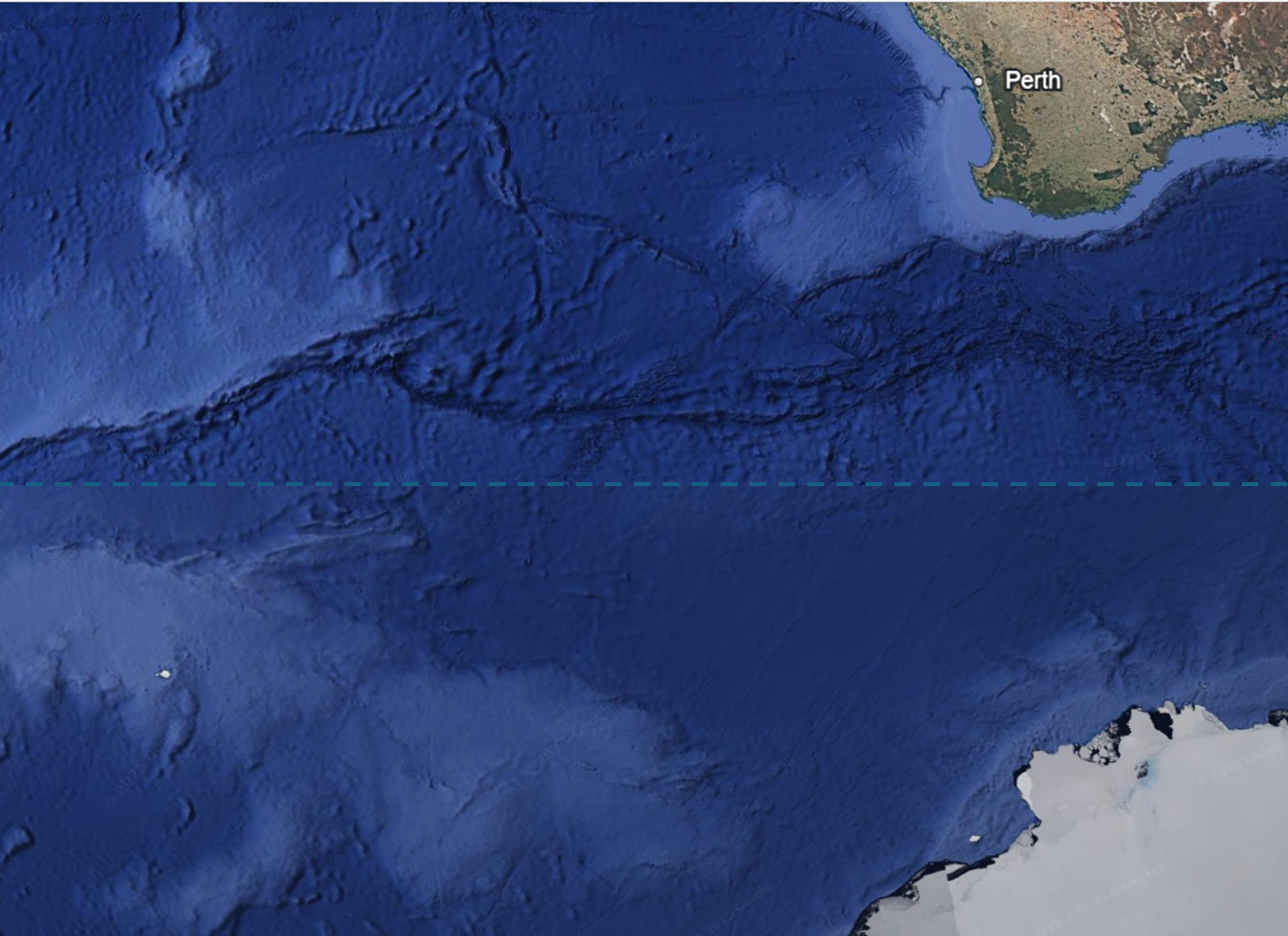
My thinking is that the lighter, shallower blobs at the top and the bottom were once connected and combined into a single structure.
|
|
| |
|
|
|
Mick Harper
Site Admin
In: London
|
|
|
|
Here's an idea just because I just had it and it will disappear otherwise, it's so bad.
1. Draw whatever it is in freehand and diagrammatically.
2. Show it to a friend and say, 'Can you see a pattern here?'
3. When they say yes, take out the Google map you have carefully secreted about your person.
|
|
| |
|
|
|
Pete Jones
Site Admin
In: Virginia
|
|
|
|
Here's what I think this shows:
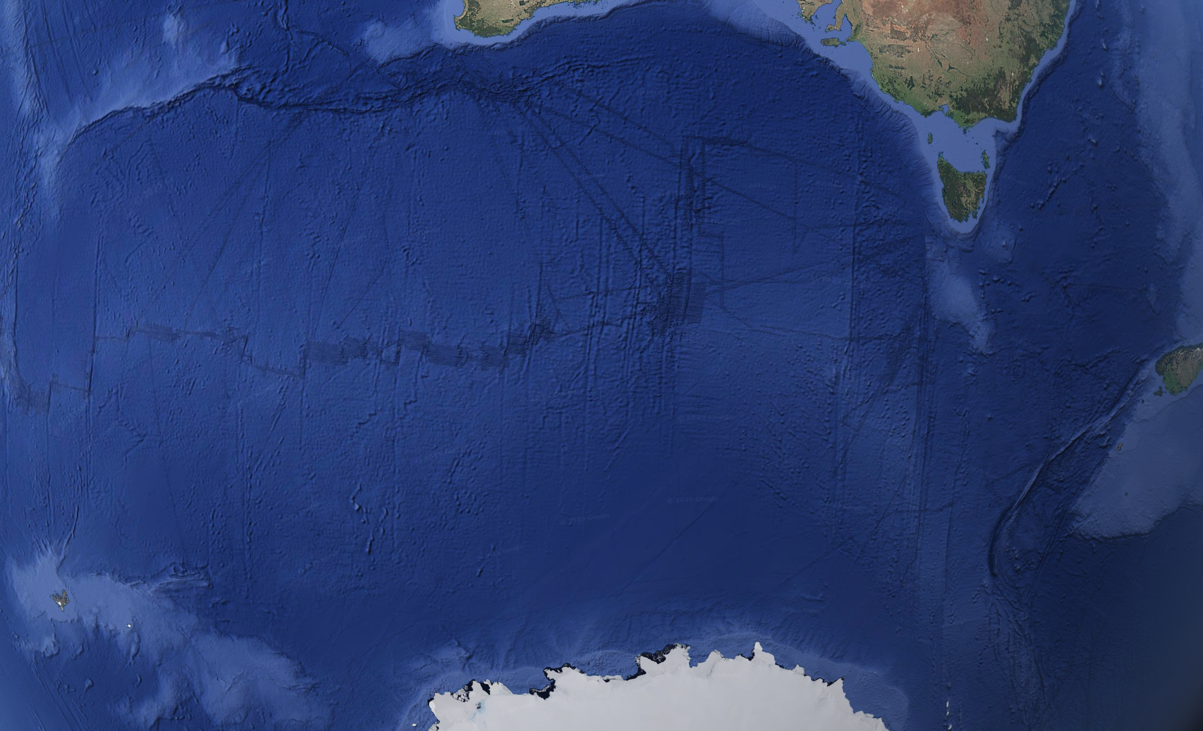
* The continents of Antarctica and Australia were once one landmass which split apart. The seafloor spread like PT says it did.
* But Antarctica is a circular land mass, so if Australia pulled away from it, then there needs to be a subduction zone on the other side of Antarctica to swallow up all the old seafloor that the 2600 km of new seafloor displaced.
* But the opposite side of Antarctica is South America, and there is no trench into which all that seafloor could go.
* Therefore the earth had to have expanded by 2600 km. None of this is original to me. It's expanding earth theory.
Here's what I don't understand:
* If this expansion happened millions of years ago, why is there any detail left on the seafloor?
* Why are the Warthogs still visible?
* Why is it as though there is no erosion underwater? (Maybe there shouldn't be, I don't know)
* Why does some of the seafloor show the bumpy spreading pattern, while other parts are perfectly smooth?
* If the earth expanded from a no-ocean-basin state to its current state, then why are their not expansion ridges everywhere?
* Did the areas that are visibly ridged expand (much) more recently than the smooth areas?
|
|
| |
|
|
|
Pete Jones
Site Admin
In: Virginia
|
|
|
|
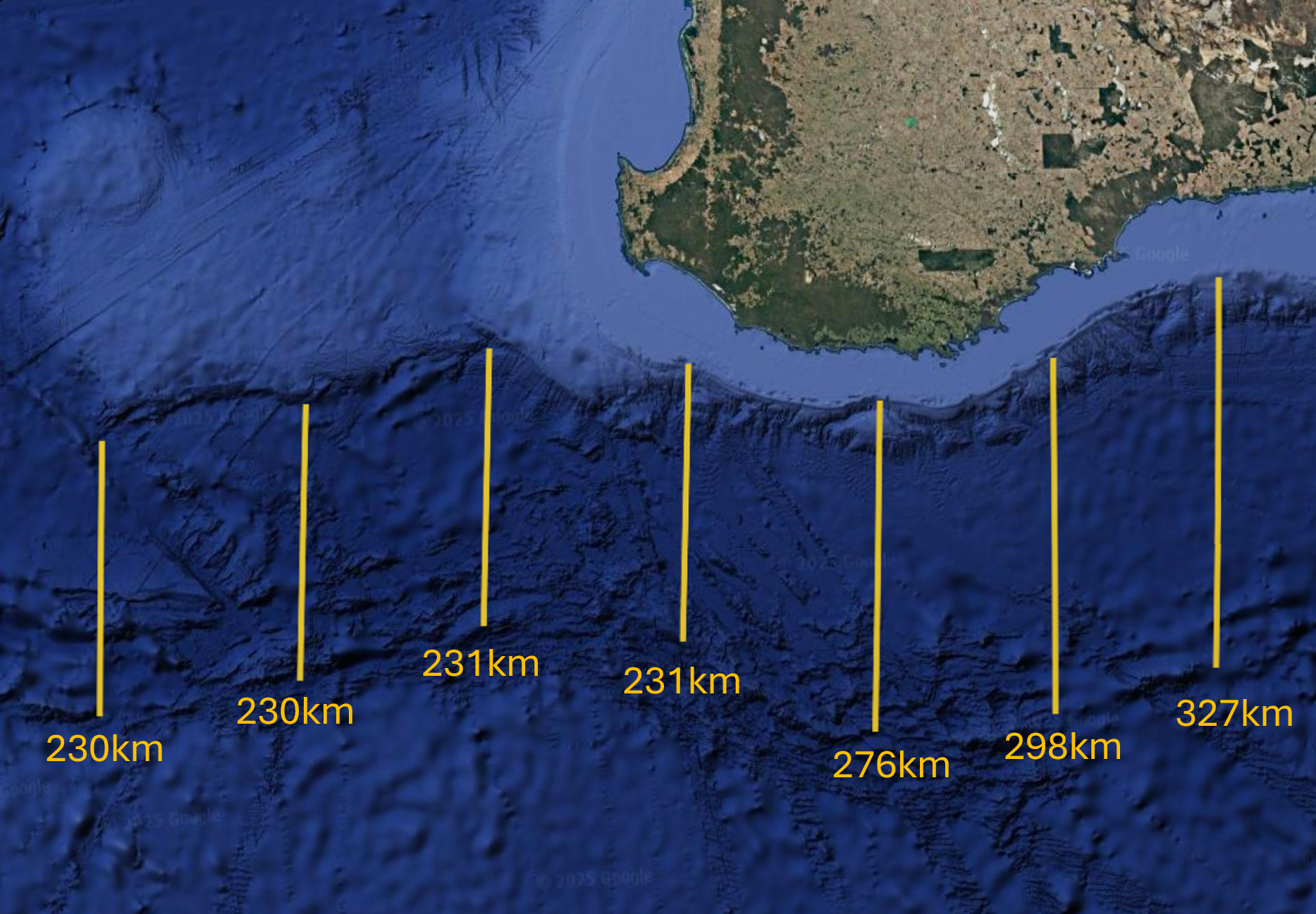
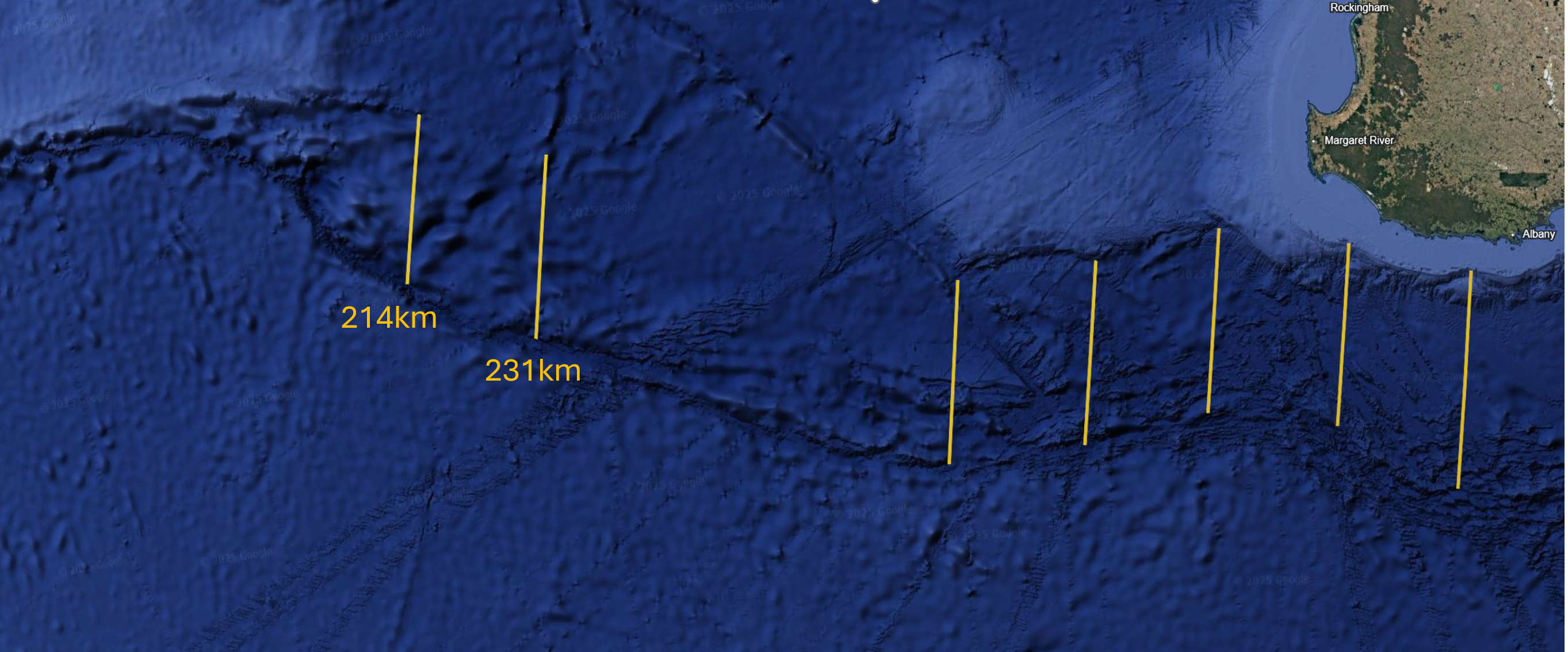
But back to observations. Here's where we started, with the slanty eyes and the shapes that curl in the opposite directions.
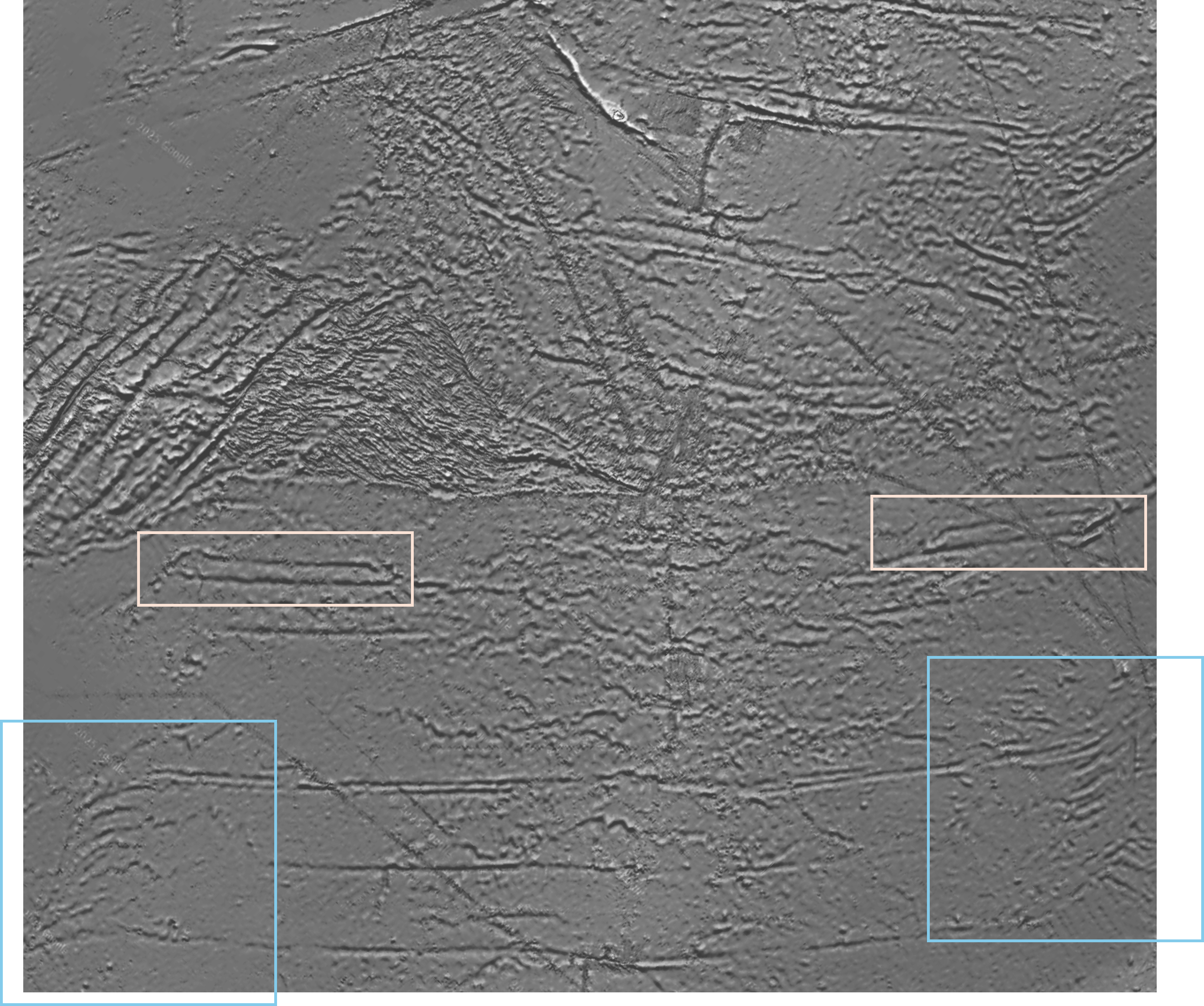
The great big gash right above it all is almost unique in the world. It looks like a big Dune-ish sandworm to me, shooting off from the middle out to the left.
|
|
| |
|
|
|
Mick Harper
Site Admin
In: London
|
|
|
|
| Pete Jones wrote: | | Here's what I think this shows: The continents of Antarctica and Australia were once one landmass which split apart. The seafloor spread like PT says it did. |
They are still one landmass, that's the bit no-one seems to realise. The fact that there is a puddle of water lying on that landmass is neither here nor there when it comes to geomantic forces.
| But Antarctica is a circular land mass, so if Australia pulled away from it, then there needs to be a subduction zone on the other side of Antarctica to swallow up all the old seafloor that the 2600 km of new seafloor displaced. |
Current sea-level has artefactually created two continents, both of which are 'blobby' i.e. quite different from the other landmasses. Something to think about.
| But the opposite side of Antarctica is South America, and there is no trench into which all that seafloor could go. Therefore the earth had to have expanded by 2600 km. None of this is original to me. It's expanding earth theory. |
Then the theory is crazy. One landmass has a long thin peninsula pointing to a long thin peninsular in the other. If this can be explained by an expanding earth, I'm a Pangean wombat.
| Here's what I don't understand: If this expansion happened millions of years ago, why is there any detail left on the seafloor? Why are the Warthogs still visible? Why is it as though there is no erosion underwater? (Maybe there shouldn't be, I don't know) |
Millions of years of no expanding earth either. Unless you're going in for the old punctuated expanding earth theory a.k.a. 'It happened when we need it to have happened.'
| Why does some of the seafloor show the bumpy spreading pattern, while other parts are perfectly smooth? |
Well, yes, that would be the whole enchilada. Though if it is to qualify as a Prime Mover Theory, it has to be a one-theory-fits-all. Like... er... Plate Tectonics.
| If the earth expanded from a no-ocean-basin state to its current state, then why are their not expansion ridges everywhere? |
It's your theory, you can cry if you want to. What is a non-ocean-basin earth again? I forgot.
| Did the areas that are visibly ridged expand (much) more recently than the smooth areas? |
I think Occam ordains that it is either a smooth plain that got rucked, or a higher plain that got grooved.
|
|
| |
|
|
|
|
|
|
|
|
Bridging physics and Earth science – Geophysics applies physical principles to understand Earth’s structure, processes, and dynamics.
Essential for resource and hazard studies – It plays a key role in exploring natural resources and assessing risks like earthquakes and volcanoes.
|
|
 |
|
|
|
Mick Harper
Site Admin
In: London
|
|
|
|
| Sotan wrote: | | Bridging physics and Earth science – Geophysics... |
That's what the word suggests.
| ...applies physical principles to understand Earth’s structure, processes, and dynamics. |
Except geophysics is the preserve of geographers, not physicists. And it shows.
| Essential for resource and hazard studies – It plays a key role in exploring natural resources and assessing risks like earthquakes and volcanoes. |
I suppose theoretically it should but if you can show instances when it ever has, I'd be much obliged.
|
|
| |
|
|
|
|
