| View previous topic :: View next topic |
Mick Harper
Site Admin

In: London
|
|
 |
|
For reasons which you need not worry your pretty little heads about, it has been found imperative to etch on the earth's surface a line that points to True North (I think that means the present North Pole). This has to be a) unambiguous and b) not subject to erasure, accidentally or deliberately, by man or nature over several thousand years.
How best to achieve this? When you've all given up and uttered the magic invocation, "Tell us, O Mighty One" I will. And then where you can go and look at it.
|
|
 |
|
 |
|
Keimpe

In: Leeuwarden, Frisia
|
|
|
|
| Mick Harper wrote: | | How best to achieve this? |
By making this line as far away from humans and natural erosion as possible.
Better yet: by making the line 'invisible' to humans even if they're actually standing on it.
I say Nazca.
|
|
| |
|
|
|
Mick Harper
Site Admin
In: London
|
|
|
|
| By making this line as far away from humans |
Up to a point. Remember, humans have to be able to consult it from time to time.
| and natural erosion as possible. |
Nice one.
| Better yet: by making the line 'invisible' to humans even if they're actually standing on it. |
Up to a point. Remember, humans have to be able to consult it from time to time.
I say No, Zir.
|
|
| |
|
|
|
Keimpe
In: Leeuwarden, Frisia
|
|
|
|
| Mick Harper wrote: |
| Better yet: by making the line 'invisible' to humans even if they're actually standing on it. |
Up to a point. Remember, humans have to be able to consult it from time to time. |
I was distinguishing between people 'in the know' and all others who would immediately try to find an excuse (mostly religion or bypass building) to demolish it.
I have another guess but I'll wait for our members from obscure time zones to give it a shot.
|
|
| |
|
|
|
Mick Harper
Site Admin
In: London
|
|
|
|
|
Certainly the secret has been preserved till 2nd July 2012. Wait, there's a knock on the door. Oh, it's two men in black. Must be my Tesco delivery.
|
|
| |
|
|
|
Mick Harper
Site Admin
In: London
|
|
|
|
Well done, everybody! So many ingenious suggestions. However, none of you got it right. What you do, what the Megalithics did, was to select a suitable offshore island ie one that was out of the way but not too out of the way, long and narrow, oriented roughly north-south and made of fairly non-erosive rock (ie granite).
Then they used methods a la Megalithic Empire to chip off bits so that just one long sliver of land, unobstructed by the sea, stretched from one end of the island to the other and that was a) the longest such 'leyline' of land on the island and b) precisely oriented north-south.
Now you have three tasks:
1. identify the island
2. make sure using GPS or whatever that my claim is correct
3. Identify the two methods for establishing bearings (one north-south the other east-west) so that the island could be identified by anybody coming along later when memories had faded.
|
|
| |
|
|
|
Mick Harper
Site Admin
In: London
|
|
| |
|
|
|
Keimpe
In: Leeuwarden, Frisia
|
|
|
|
|
Aaaah, I see, you re-read John Michell's book ;-)
|
|
| |
|
|
|
Keimpe
In: Leeuwarden, Frisia
|
|
|
|
| Mick Harper wrote: | | 3. Identify the two methods for establishing bearings (one north-south the other east-west) so that the island could be identified by anybody coming along later when memories had faded. |
Do you mean visual bearings? The island looks unnaturally flat to me.
|
|
| |
|
|
|
Hatty
Site Admin

In: Berkshire
|
|
|
|
North-south bearing: Worm's Head.
East-west bearing: Stonehenge.
|
|
| |
|
|
|
Mick Harper
Site Admin
In: London
|
|
|
|
| Aaaah, I see, you re-read John Michell's book ;-) |
Remind me. Actually I'm getting this from The Secret Land by Paul Broadhurst, though the material is by Robin Heath. What is mine is
a) the idea that the longest line on Lundy Island (which is the island in question to those still struggling to keep up) is a north-south bearing (the authors are a bit vague) and
b) that the island was artificially chiselled into this state.
Which is why I'd like somebody to check this out.
As to finding it again, Hatty is correct to opine that building Stonehenge, which is exactly due east of Lundy, would be quite a good method. However, they could not be certain that Stonehenge would last the test of time--it could have been bulldozed at any ttime--so they built three towns on the Welsh side of the Bristol Channel with identical names to three towns on the English side, each pair being equidistant from the latitude of Lundy Island.
Thus Trefdraeth (Welsh name) is opposite Tywardreath (Cornish name)
St Clears (Welsh name) is opposite St Cleer (English name) and
Llanstephan (Welsh name) is opposite Launceston (English name)
and the halfway point between each town (each of which is due north/south of the other) is the latitude of Lundy Island.
|
|
| |
|
|
|
Keimpe
In: Leeuwarden, Frisia
|
|
| |
|
|
|
Keimpe
In: Leeuwarden, Frisia
|
|
|
|
| Mick Harper wrote: | | As to finding it again [.....] they built three towns on the Welsh side of the Bristol Channel with identical names to three towns on the English side, each pair being equidistant from the latitude of Lundy Island. |
That's an amazing find (is it yours?). Although to me these six towns don't look like aids in finding Lundy. It's more like "now look, professor, how much more of this need I show you before you stop telling everyone it's all a coincidence?"
|
|
| |
|
|
|
Mick Harper
Site Admin
In: London
|
|
|
|
| That's an amazing find (is it yours?). |
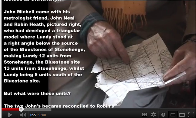
No, no, from the book (highly recommended by the way, it presages The Megalithic Empire in all manner of ways). As your Michell film shows, lines drawn from Stonehenge to Lundy Island and to the Preseli Bluestones quarry form an exact 5,12,13 Pythagorean triangle with the '12' side pointing precisely along the east-west axis (that is Stonehenge to Lundy).
What is less well-known (which is amazing and is also thanks to Heath) is that the three capitals of Britain--London, Edinburgh and Cardiff--form a 5,12,13 Pythagorean triangle with the '12' side (that is Caridff to Edinburgh) pointing precisely along the north-south axis.
The northern apex of the triangle is at Arthur's Seat, the big volcanic hill that dominates Edinburgh. The point of the book is that Arthur is the Great Bear and the constant key to finding north (since the Great Bear aka the Plough circles the Pole Star).
Since the capitals (especially Cardiff) are a very modern feature this may be grist to the "you can prove anything with this kind of thing" school. And the book itself, which features various animals in the landscape à la the Glastonbury Zodiac, is a case in point. However it also 'proves' the old AE contention that crazy thinking can unlock the non-crazy world.
|
|
| |
|
|
|
Hatty
Site Admin
In: Berkshire
|
|
|
|
Somewhere we discussed Arthur in relation to The Plough. Cart before bear. The legend won't go away, Arthur is the great smith who still sleeps underground and sites linked to Camelot and last battles are mining areas, Cornwall and Wales are generally favoured.
The whole subject of archaeoastronomy is a minefield in which the mines are ignored. The Michael Line itself connects the Cornish tin mines to the Norfolk flint mines.
FYI, in mythology north is the direction of the moon god/goddess (Pole Star) in varying guises.
|
|
| |
|
|
|
|