| View previous topic :: View next topic |
Pete Jones
Site Admin

In: Virginia
|
|
 |
|
The 2600 km span continues almost uninterrupted:
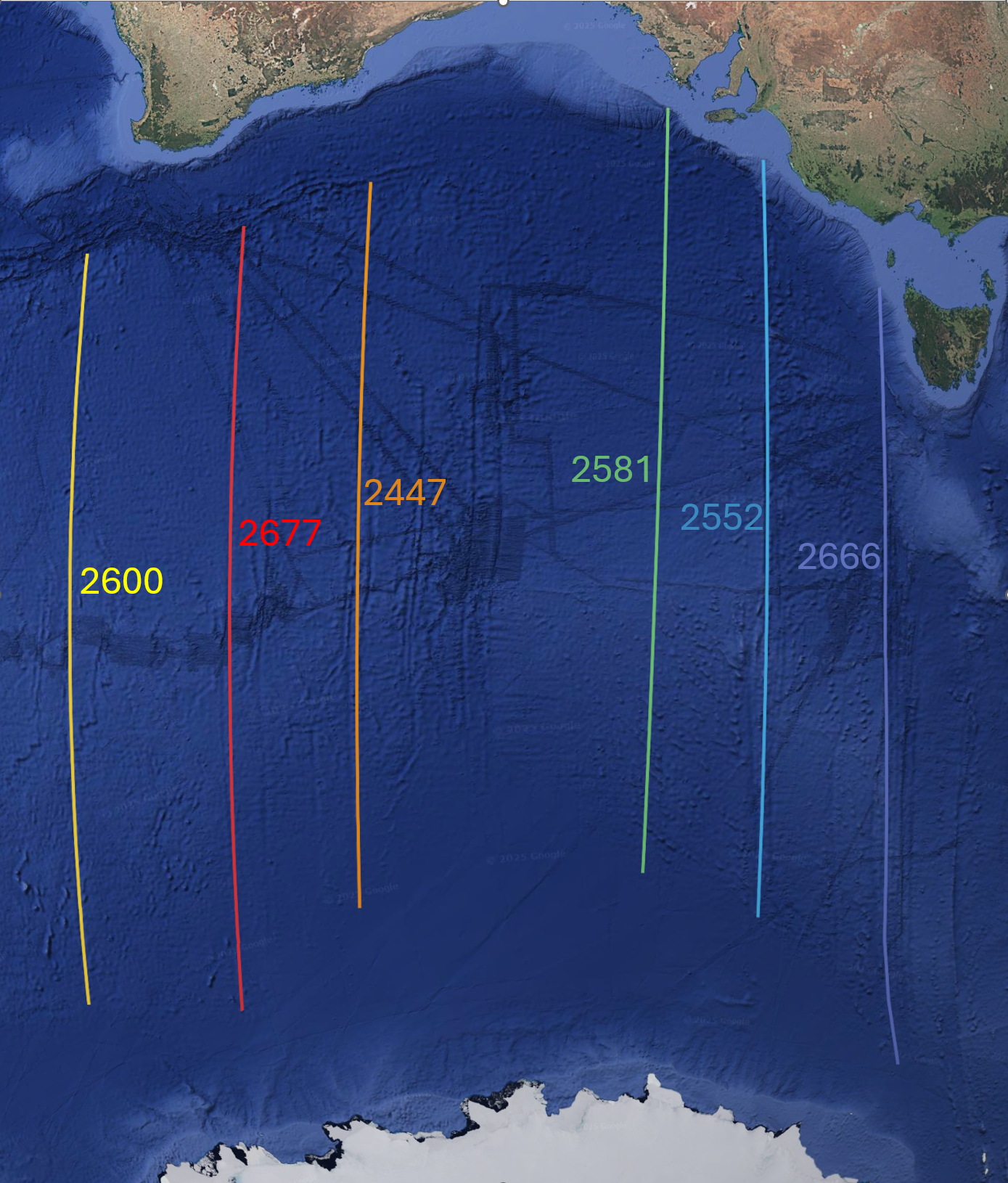
These are all set in my Google Earth project, which measures them to the hundredth of a kilometer.
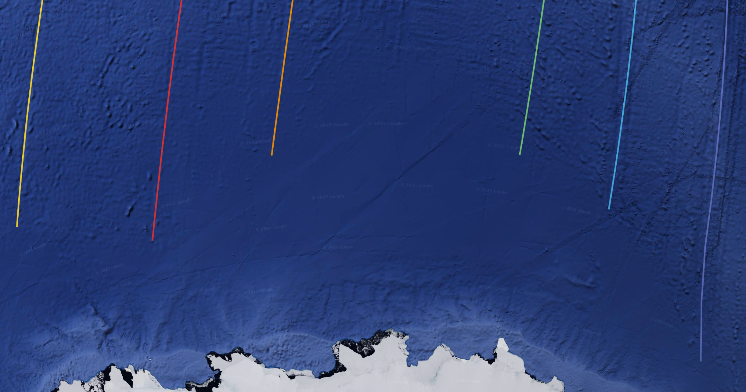
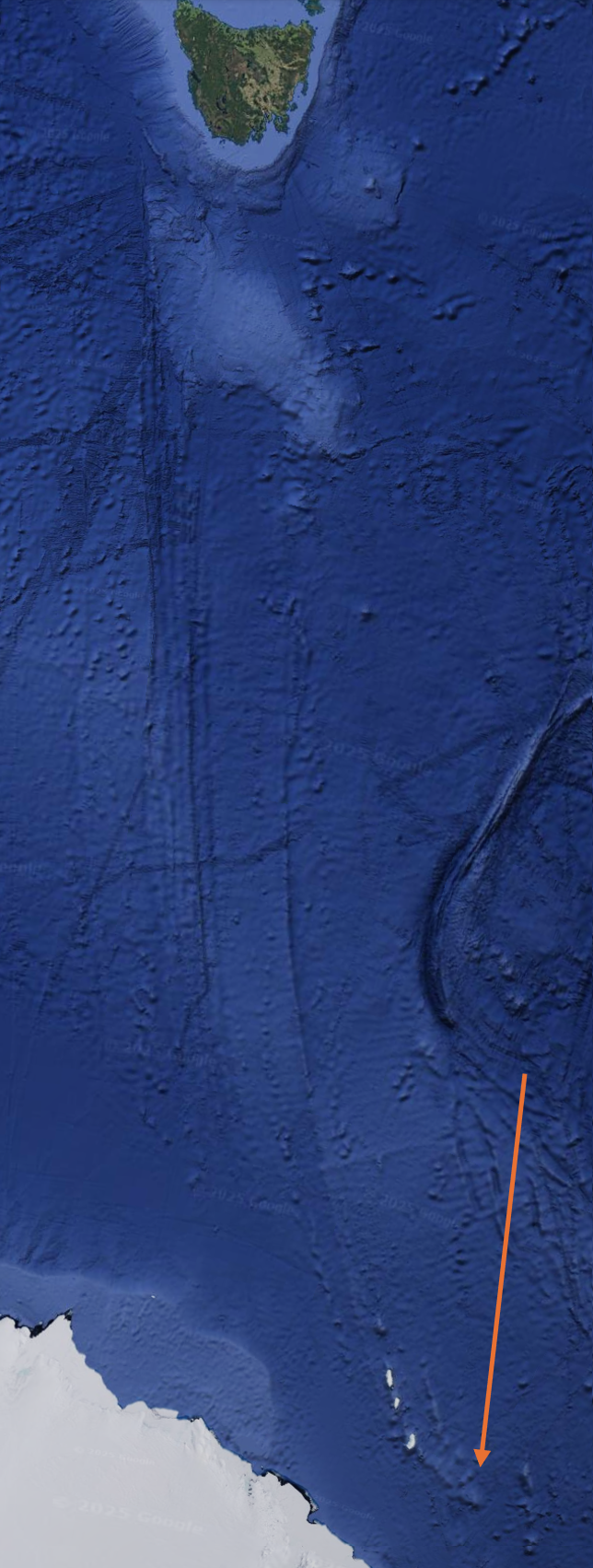
Regarding the bottom end points. There is a vague but still discernible change in the texture of the seafloor. It goes from a bit bumpy to smooth. I ended the lines where I saw the last of the bumpiness.
Here is the shift from bumpy to smooth:
|
|
 |
|
 |
|
Pete Jones
Site Admin
In: Virginia
|
|
|
|
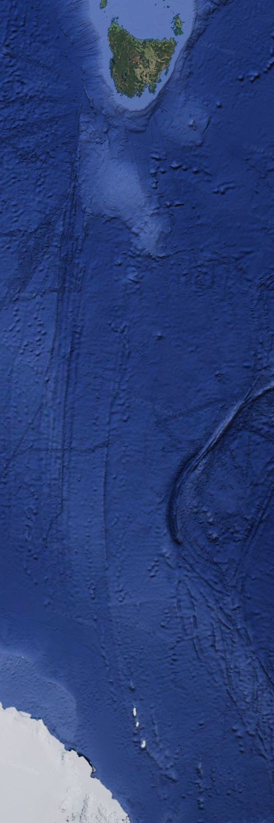
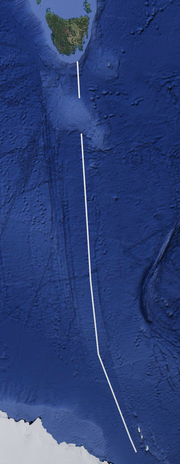
Next is the stretch from Tasmania to Antarctica.
I expect 2600 km to appear prominently, so here's the line:
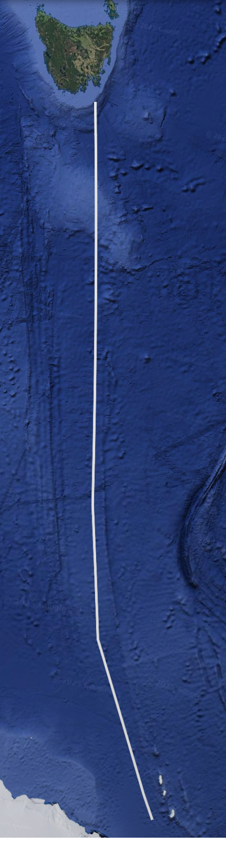
But unfortunately its 2858 km. This excess of 250-ish km is too much...unless
|
|
| |
|
|
|
Pete Jones
Site Admin
In: Virginia
|
|
|
|
There is an undersea bit of raised land south of Tasmania. The lighter blue.
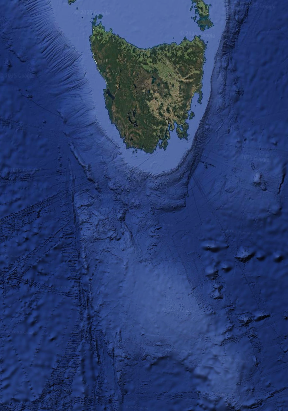
I don't know what orthodoxy considers this blob to be made up of, and I'm not going to look it up (yet). I am taking it as continental crust and not part of the seafloor.
And that means that I'm skipping over it, removing it from my measurement, so that I'm only measuring sea floor.
And you get:
Long white line: 2320 km
Short white line: 270 km
For a total of 2590, spot on with the magic number.
|
|
| |
|
|
|
Mick Harper
Site Admin

In: London
|
|
|
|
He's going much too fast for me but I expect there are people out there with swifter brains than mine, more attuned to spatial geometry. I can't even park a car, though admittedly I've never tried. As I always say
| A picture is worth a thousand words. Then you can post up the next picture. | |
|
| |
|
|
|
Pete Jones
Site Admin
In: Virginia
|
|
|
|
I'll slow my roll.
Let's dwell on Tasmania. There are two places/pathways I want to look at: the white line in the posts above, and this one:
The orange arrow points to where I propose to start my measurement. I expect we'll get to 2600 km, because this is all part of the broader structure that I've been tracing across---checks map---31 million square kilometers of open sea.
Here's the first distance we get, before we run out of seafloor (and smack into the oddly raised blob south of Tasmania:
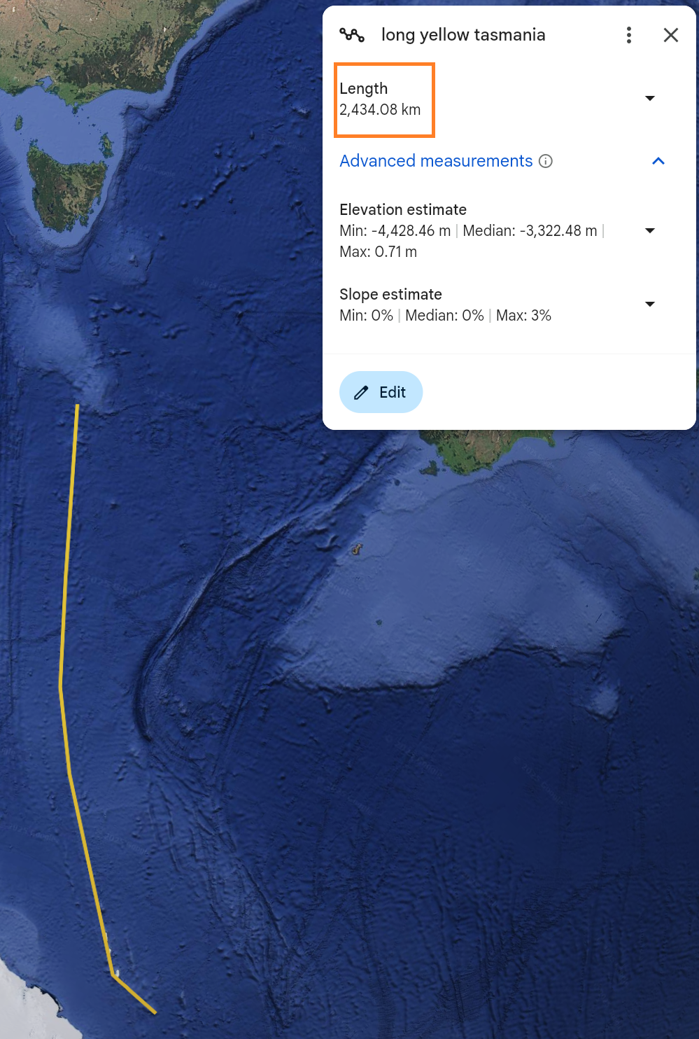
2434 km? Not quite enough kilometers for my liking. And we're still not to the main continent yet. I want to measure another little chunk of seafloor and I want that chunk to be something like 165 km, so that we get really close to our total of 2600.
But if you look north of the little blob, it's not looking good....
|
|
| |
|
|
|
Ishmael

In: Toronto
|
|
|
|
|
Facinating thread.
|
|
| |
|
|
|
Pete Jones
Site Admin
In: Virginia
|
|
|
|
I won't bore you with another picture and measurement. Suffice it to say that the yellow Tasmania line does not end up equaling 2600 particularly closely - no matter how I measure the apparent seafloor up by the east coast of Tasmania. It gets to more like 2800 or 2900. I'm going to set it aside and keep going.
So, next, New Zealand (and the surrounding undersea geographical structure)
|
|
| |
|
|
|
Pete Jones
Site Admin
In: Virginia
|
|
|
|
First, we have to start at the obvious place. No cherry picking of starting points. And starting points are either obvious, or they can't be starting points. That said, here's one:
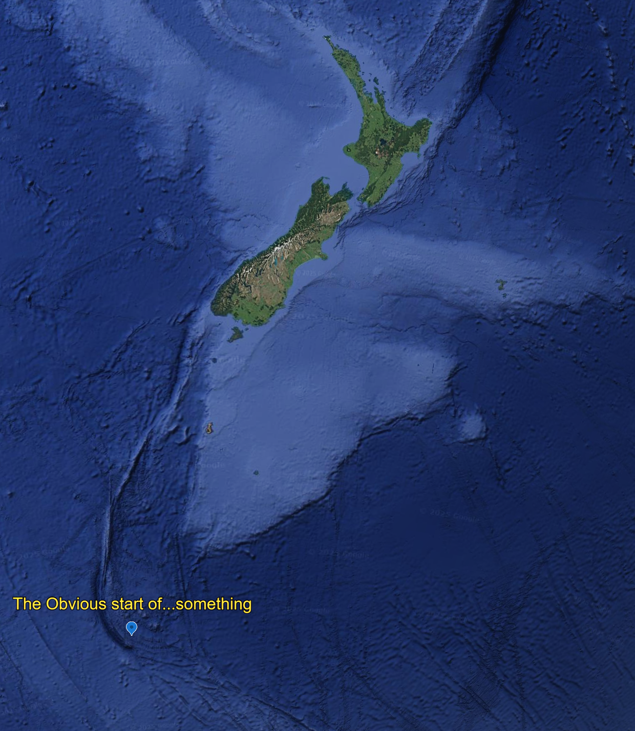
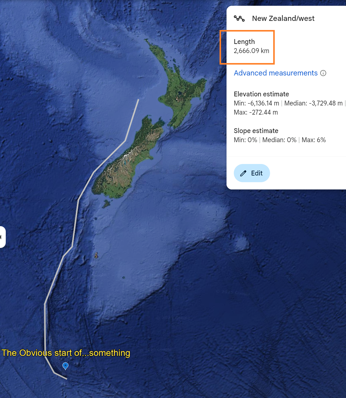
If this greater New Zealand structure is related at all to the rest of my 37 million square mile chunk of Earth, we should be able to find a 2600 km end point. Here's what we find out at the 2600-ish mark:
But is this stopping point special or cherry picked?
|
|
| |
|
|
|
Mick Harper
Site Admin
In: London
|
|
|
|
|
I assume you meant your line is 2660 miles long, not the length of New Zealand being 2660 miles. (As I first thought from your legend.) You have arrived at the Cook Strait. I like 'straits' too.
|
|
| |
|
|
|
Pete Jones
Site Admin
In: Virginia
|
|
|
|
|
Yes, I was calling the overall structure, including the seafloor south of it, "New Zealand". Will fix it in the morning
|
|
| |
|
|
|
Pete Jones
Site Admin
In: Virginia
|
|
|
|
Cook Strait, yes. But also a triple convergence of different seafloor depths.
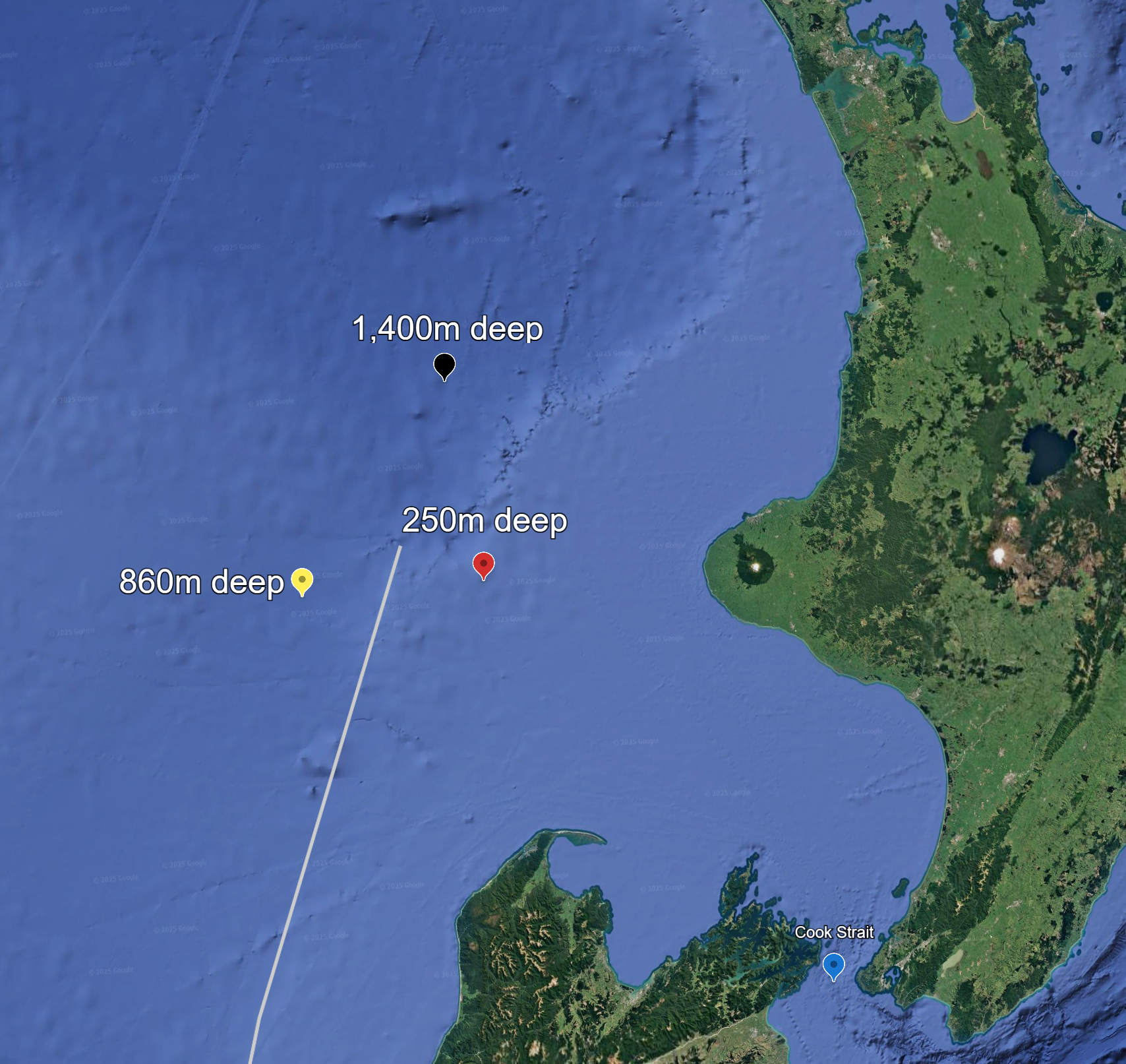
Zoomed out, you can see three general "provinces" of depth:
Reds: Around 0-100m
Yellows: Around 600-900m
Blacks: Around 1400-2200m 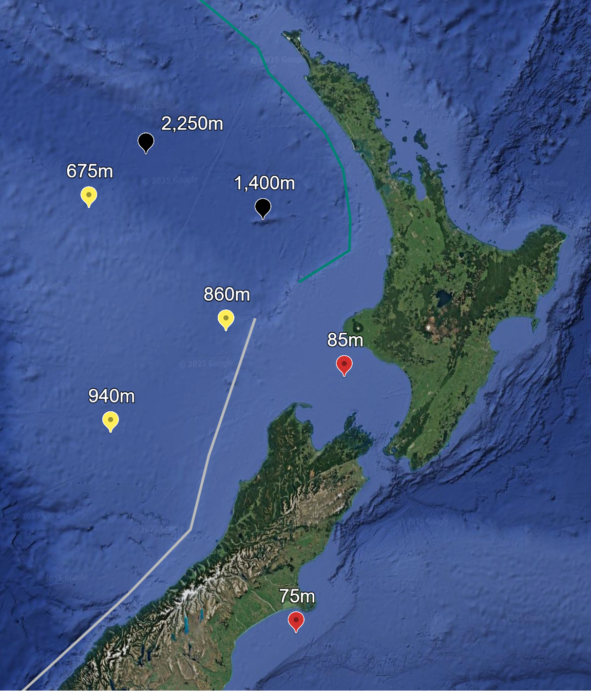
The 2600km number hits right at the meeting point. Is this significant?
|
|
| |
|
|
|
Mick Harper
Site Admin
In: London
|
|
|
|
|
It had better fookin' be.
|
|
| |
|
|
|
Pete Jones
Site Admin
In: Virginia
|
|
|
|
It better, I agree. But I'll come back to it. Here's what it looks like to me so far.
The dark lines (they're vertical in the image below) are trackways left in the seafloor, showing where two pieces of geography were once joined up. This is entirely orthodox Plate Tectonics (and Expanding Earth).
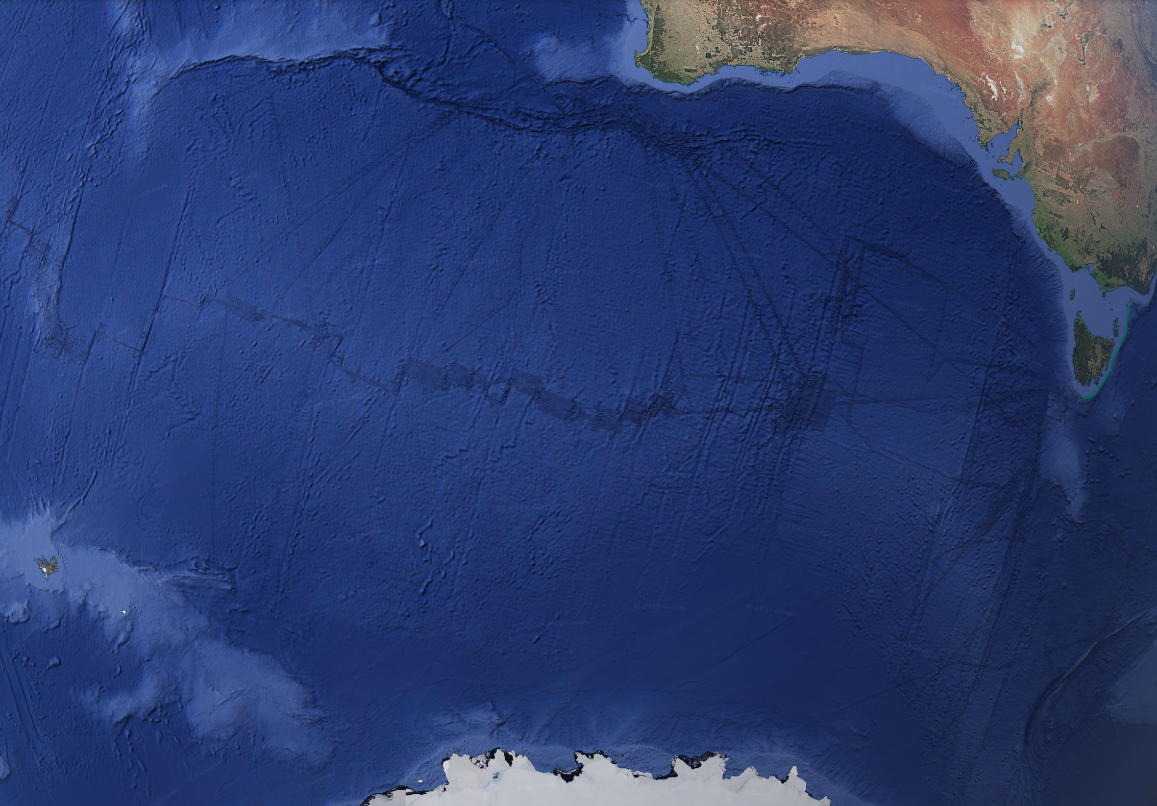
Above, you notice the very dark EKG-looking line going horizontally across the middle? These darker lines appear to be the exact track of ships or subs mapping the seafloor. When I zoom in on one of them, you can see that they are much more highly detailed. The fidelity of the SONAR (or whatever) seems better directly under the boat/sub.
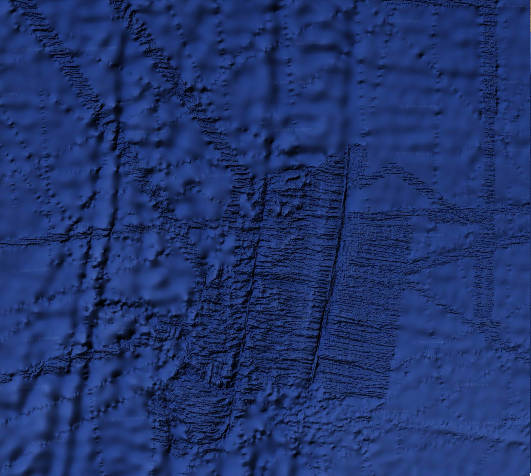
This closeup shows distinct textures. Note the diagonal lines of greater detail coming into the squarish area that also has greater detail. I am assuming the diagonals show the path the ship took on its way. There are probably clear answers to this, but I wouldn't know where to find them.
|
|
| |
|
|
|
Mick Harper
Site Admin
In: London
|
|
|
|
It might be useful knowing the depth of the ocean. If it is shallow there is always the possibility of something mundane like a trawl -- not just fishing but nodule mining. If it is abyssal (ooh! worked it in) then there is the question of artefacts arising from the use of (or the recording of) electronic equipment. I suppose we ought not to rule out absolutely the spoor of nuclear submarines.
We are hampered by some of these activities being either secret or illicit but I am happy to assume everything is natural unless proved otherwise.
|
|
| |
|
|
|
Pete Jones
Site Admin
In: Virginia
|
|
|
|
| Mick Harper wrote: | | It might be useful knowing the depth of the ocean. |
Bizarrely, my ability to measure depth disappeared this morning. Maybe Google wants money from me before I continue. But I bet it returns, and randomly.
|
|
| |
|
|
|
|
